


Future Residential Layers Now Available in Planned Grocery and Why It’s a Big Deal
By David Z. Beitz
It has been a crazy six weeks for the Planned Grocery team. Back on January 27, we were acquired by BCI Media Group and since then it has been a whirlwind of activity. (You can read the full release here).
The great thing about merging with BCI is that we are now a part of a much larger team that is already doing what we are doing, but on a much bigger scale. And when I say bigger scale, picture a company who tracks all construction activity in the United States, Australia, New Zealand, and Asia.
We are bringing over some creative geospatial skills as well as a unique understanding of the commercial real estate and grocery retail sector. By joining forces, we will be able to take Planned Grocery to the next level and create some new products.
Just this week we announced that Planned Grocery now includes the option to add two residential layers from BCI. These layers will display and calculate the planned multi-family and planned single-family projects across the United States. (See the coverage by Winsight Grocery Business here)
Why is this a big deal? First, we had this integration working in three weeks, before we had even fully transferred over to the new systems at BCI. Second and more importantly, I think the ability to see planned residential takes the Planned Grocery platform to another level.
Imagine that you are looking for a new site for a grocery store, now you can see all the multi-family and single-family developments planned and under construction nearby. Or imagine you oversee shopping center acquisitions and now you can compare deals in part on how much residential is planned nearby.
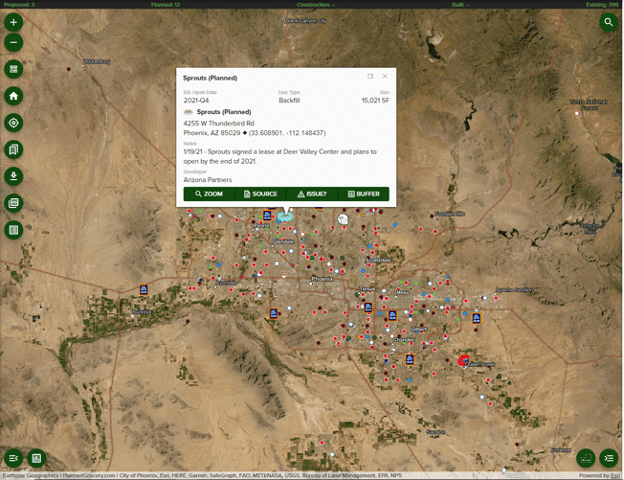
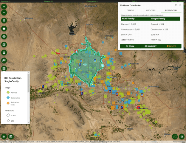
For example, check out Phoenix, AZ below where there is a planned Sprouts Farmers Market. Each dot on the map is an existing grocery store and each logo of a grocery store represents a store that is either proposed, planned, under construction, or recently built within the last 6 months.
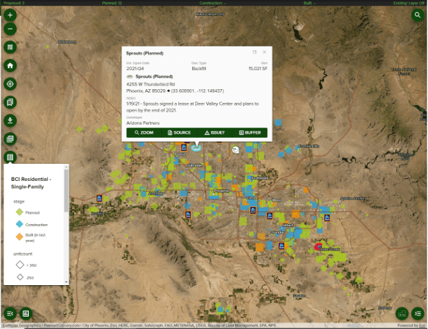
Now if you turn on the new residential layers from BCI you can see where the multi-family and single-family projects are. The multi-family developments are represented by squares and the single-family developments are represented by diamonds. You will notice that the larger single-family developments are planned on the outskirts of town where larger tracts of land are available.
When you click on a residential project you get basic information on the number of units, the stage of the project, location, and construction timing.
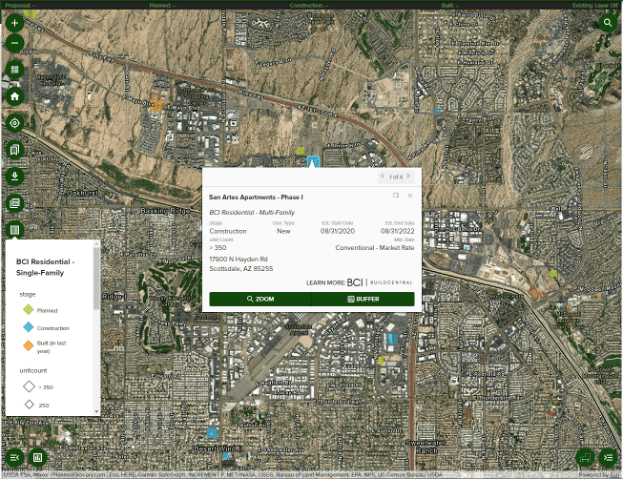
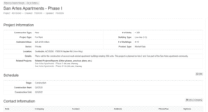
If you click on the LEARN MORE button and you have a subscription to BuildCentral construction data, you may then access a lot more details on the project such as the architect, engineer, general contractor etc, and their contact details.
Finally, with our new integration in the Planned Grocery platform, you can calculate the number of residential units planned for a radius, drive time, or trade area. The below example is for a 20-Minute Drive Time Buffer. On the upper right you can see the total multi-family and single-family units for this area. These numbers are broken down by planned, under construction, and built over the past 12 months.
Over the past two weeks we have been meeting with current Planned Grocery customers to introduce the BCI team and get feedback on the new residential layers. The feedback has been very positive, and many see these new layers as a great new addition to help with better understanding the markets they work in.
We recently did a customer webinar on the new BCI residential layers.
(If you would like to see a replay you can check it out at this link using passcode N8!2j?!d)
For more info on Planned Grocery and the new residential layer, please contact Alex DeLoach or give us a call at 888.511.5866.